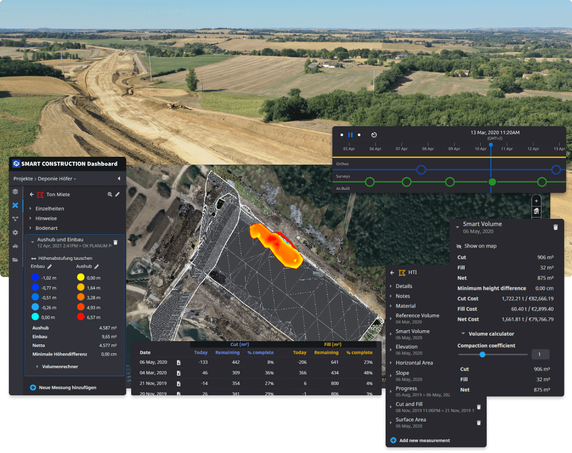
Cut and Fill Calculations within seconds. Visualize Drone, Machine and Survey data as a 3D model
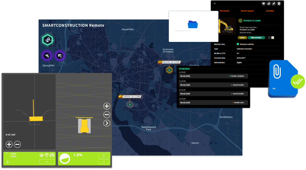
Send new design data to machines in the field, or remotely support operators, without traveling to the jobsite
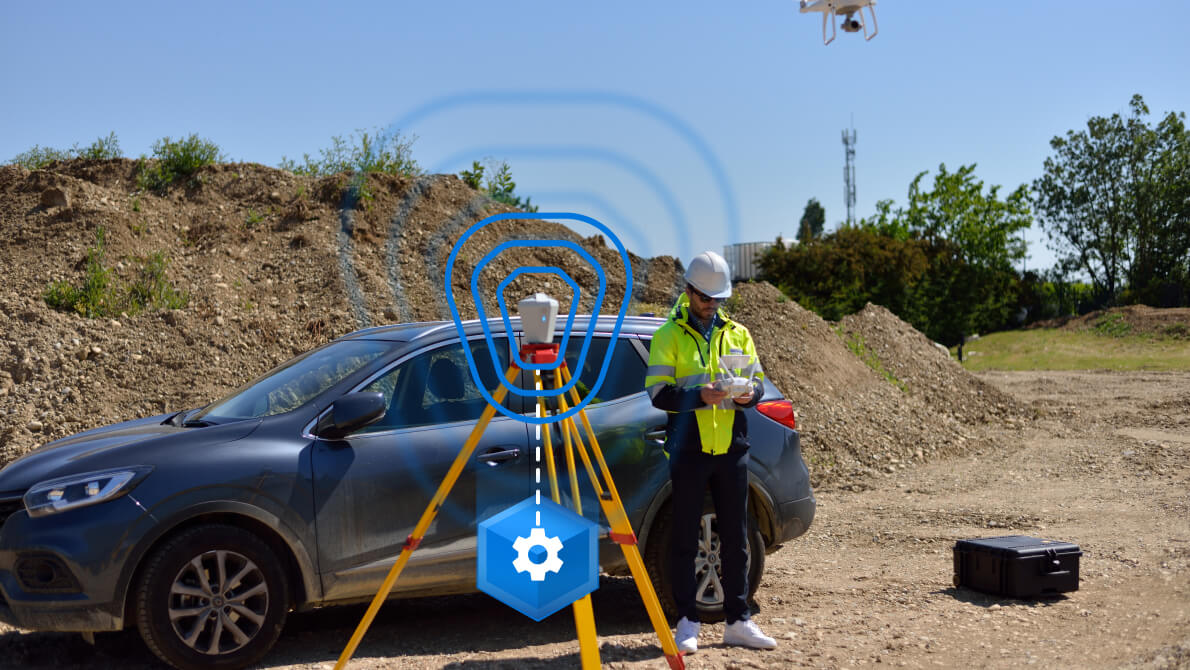
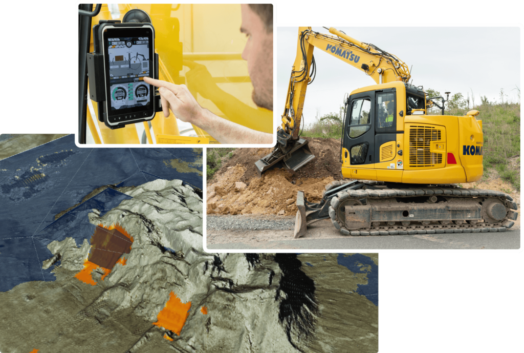
Collect as-built and payload information with our 3D machine guidance kit for mixed fleet