Rapid processing of drone data to create a 3D terrain map before leaving the jobsite.

Komatsu Smart Construction Edge Logo

Simplified drone surveying for everyone to capture full terrain surveys

Drone surveying becomes a streamlined easy process for both experts and non-experts with achievable results under an hour, safely away from the dangerous of a construction site.
Komatsu Smart Construction Edge Drone Surveying Stockpiles aggregates
Smart Construction Edge Drone Data Processing SFM
Smart Construction Edge is a unique device that allows both surveying experts and non-experts to perform accurate drone surveys and to process the flights into point clouds.

Our simplified workflow eliminates all manual calculations and technical hassle, streamlining the process so that everyone can map the full terrain seamlessly.

Place the Edge in an open sky area
Drone survey the jobsite
Start processing the data already on site
Access data on the jobsite or in the office

Under the hood of the industries’ new drone surveying workflow

Say goodbye to Ground Control Points (GCPs)

Maximize safety and efficiency with Smart Construction Edge! When flying PPK, simply set up Edge as a PPK base station to track and integrate correction data into your dataset — keeping your team safely out of active sites. No more worries about operators driving over ground control points.

Komatsu Smart Construction Edge Ground Control Points

SfM (Point Cloud Processing)

3D processing of your flight can happen on-site, in the car, or at the office seconds after your drone touches the ground, with no internet connection required. Tweak your output by adjusting the quality, removing vegetation, and including a detailed Digital Elevation Model.

Automatic removal of
unnecessary objects

Edge automatically removes obstacles like machinery and buildings from the point cloud, drastically cutting down manual cleanup and speeding up your access to valuable insights. Ideal for both surveyors and job site managers.

Komatsu Smart Construction Edge Automatic Object Removal Objects Komatsu Smart Construction Edge Automatic Object Removal No Objects
Komatsu Smart Construction Dashboard Point Cloud of Construction Site

Connecting the Edge to the Smart Construction ecosystem

With Edge, you can effortlessly send your processed point cloud directly to Smart Construction Dashboard via the cloud, eliminating the need for wires or external memory. This creates a unified and efficient workflow. Dashboard serves as a data sandbox, ready to collect soil movement information not only from drones but also from machines, rovers, and handheld 3D scanners. Start tracking your site progress with 3D data to streamline your management processes.

Modern construction demands met by advanced hardware specifications

Komatsu Smart Construction Edge device 01
Komatsu Smart Construction Edge device 02
Komatsu Smart Construction Edge device 03
Construction-grade build quality and water / dust resistant (IP65)​
Edge is rated IP65, providing total dust protection and can handle exposure to high-pressure water, ensuring dependable performance in challenging conditions.
Mobile via battery power (12 hours) or stationary via cable​
The Edge features two professional-grade LBP-HM1 batteries, providing up to 12 hours of continuous use. With hot-swappable capability, you can easily replace batteries without downtime, ensuring uninterrupted performance.
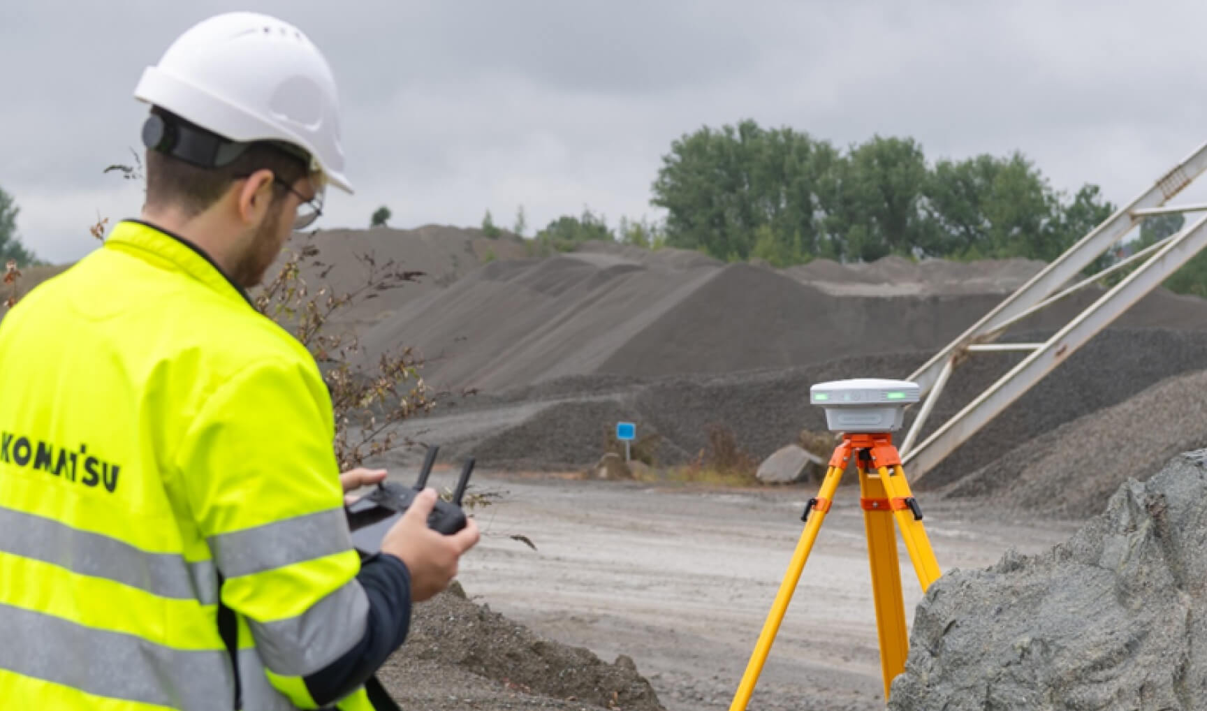
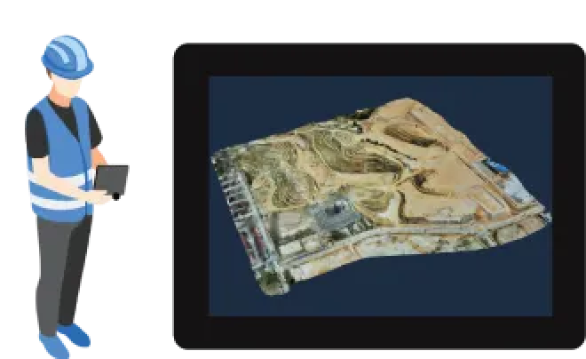
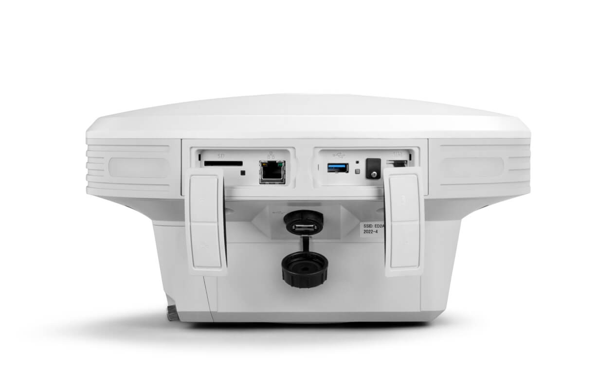
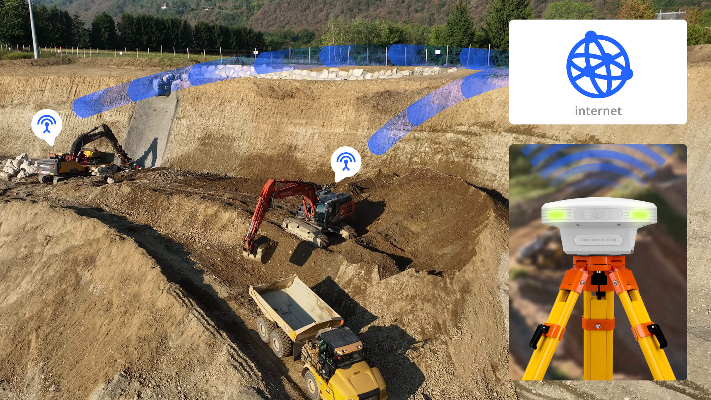
Wireless connection to Edge via tablet or computer​
All interaction, processing, and exporting are done by connecting your own device to the Edge’s hotspot, eliminating the need for fragile built-in screens. This design enhances its ruggedness, ensuring durability in harsh environments.

Additional options:

Correction data for your equipment

Activate the correction data license and upgrade the Edge into a combined processing powerhouse and base station unit. Keep all your 3D machinery on grade.

NTRIP Base Station Functionality

Instead of purchasing individual NTRIP accounts for each machine, use the Smart Construction Edge to broadcast a single NTRIP account across your entire project, allowing all machines to connect seamlessly or use it as a RTK base for your drone.

SATEL Radio Kit

When preferred, an additional radio can be attached to the Smart Construction Edge to broadcast correction data to all machines present on site.

Ready to see the Edge in action? Need some extra information? Leave your details and we will reach out.

Komatsu Smart Construction Edge Brochure Download

Download our brochure to understand all the nitty-gritty details

Turn days of data
processing into hours

Drone surveying is great, but the huge amount calculation work still remains a painful truth. With Smart Construction Edge, data processing is only a matter of hours. Once your drone flight is finished, it starts to process the flight immediately, calculates point clouds, and has a 3D model of the terrain delivered within a very short time. For a jobsite of 25.000 m2, it only requires between 20 minutes to an hour of processing time, depending on the accuracy you wish to have.

No need for Ground Control Points (GCPs)
As a someone who thinks ahead of their time, you must have done drone surveying on one of your sites or at least thought about it. But for something that should be for the future, you’re still doing a lot of manual setup, like laying down those Ground Control Points. Smart Construction Edge gives you the ability to drone survey without putting down any ground control points thanks to its onboard GPS system that takes care of all the positioning job. This makes it also a perfect tool in those areas without reception, where onboard RTK from the drone won’t work.

One Hardware solution that has great powers:

One Hardware solution that has great powers:

Turn your Phantom 4 RTK into an RTK (Real Time Kinematic) drone connecting to Edge or fly in PPK (Post Processing Kinematic) mode

Edge hardware is the most efficient data output in the market. Usable data under 30min is possible

Edge is a GNSS (Global Navigation Satellite System) base station and processing unit All In One providing drone data extremely fast in the field.

Process your data with Projection Geoid or use a Localisation.

Easily setup the Edge on a known, or unknown point by self positioning using Network Correction

Include GCP’s (Ground Control Points) to improve accuracy
Use the SMART “Checker” function to adjust the point cloud for optimum accuracy improvement.

Edge is integrated into Smart Construction Dashboard workflow using IoT

Automate your processed data by uploading it seamlessly to Smart Construction Dashboard

Processing Settings

Quality

Point Cloud Density

Vertical Off-set

Outputs

Specifications